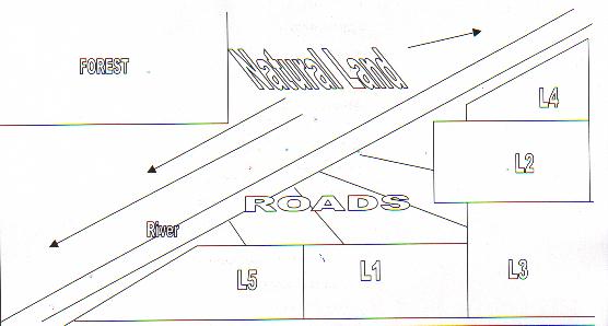
|
As a group we decided to make fewer lots and make them a larger size.
It did not seem natural to divide up all of the land and make a lot of
small lots. That would look too much like the city and we wanted to keep
a natural country atmosphere.
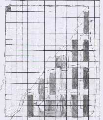
We decided that the majority of the lots would be the same size as it
was easier for us to draw the plan to scale. We also thought that even
though the size of the lots were the same, the place where the houses
were built on the lot would be different and also the design of the houses
would be different.
It would be easier to plan the roads throughout the development if the
lots were similar.
|
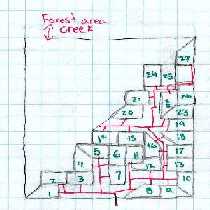
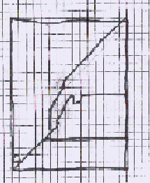
As a group we decided to keep all of the houses on one side of the river.
We knew that 1/2 of the land had to be kept natural and so this was one
way that we knew to keep 1/2 of the land natural. We decided to make all
of the lots a different shape because that way they would be different
and easier to sell to people who wanted to have their lot look different.
We knew that area did not have to be all the same shapes. It can take
on a shape of its own.
We tried to figure out the idea of scale but when we drew the lots all
different shapes we had a tough time with scale. We could find out how
to find perimeters because it is just the distance all the way around
but we were not too sure about how you find out about the distance of
the diagonal line.
|
As a group we decided to keep half of the
land without development because that way it would be considered a good
use of the environment. We decided to not do a lot of development of the
land and leave the center of the land as a park. We also decided to have
different shaped lots as we learned that the area does not have to take
the same shape. This way we were able to make the land look natural because
everything will not all look the same it won't look like a city development.
We can still connect all of the lots with a road and this way it will look
natural because there will not be a lot of development. We liked the way
that each lot has a different shape. |
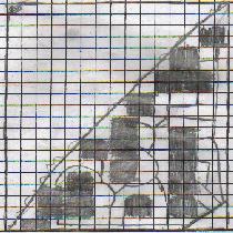
As a group we have decided to keep all of the houses on one side of the
river. We felt that this way it was natural. The houses are close together
so that the road can access them easily. We kept the land as a rectangle
because that was the easiest for us to calculate the area. We also kept
the lots square or rectangular because it was easier to calculate the
area and fit them all together.
We had to add and subtract and divide in order to figure out this problem.
We had a bit of difficulty with the idea of scale but we had help. We
had to change the big number of the area into a smaller number so that
we could calculate and we did this by finding grid paper and making everything
to scale.
|
| As a group our main discussion was about
keeping the land as natural as we could possible do and so we decided that
the only way to do this would be to make only three large lots on the one
side of the river. Then when the houses were built they could be surrounded
by trees and they would not be seen from the road. Also you would only need
very few roads because they would only need to go to three houses and this
would be natural. We also decided to take the land and make it different
shapes. Once we knew what half of the land would look like, it was easy
to divide the land up into three parcels. When you add up the total cost
of three large lots or 30 small lots, we made sure that the profit would
be the same. The developer would want to know this. |
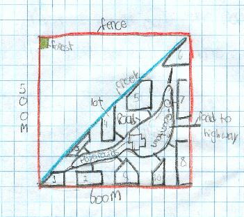
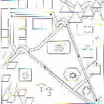
As a group we felt that if we were to take
the land and redevelop it into a park where you could camp in the summer
and cross country ski in the winter, it would be natural. There would not
be a lot of people living there year round and it would be kept up as a
park. We would keep the creek and the forest area as they are. No changes
would be made to these. We would add roads and also two bridges over the
creek so that the park could be spread out over the total land. There would
be a playground built in the center of the land and also a place to sign
in so that the total number of the people in the park could be controlled.
The tents sites would be in the north west corner of the development and
also in the bottom south west corner. There would only be three houses built
on the land for the people who work year round at the park. In the northeast
corner of the land there would be a swimming pool built. |
As a group we decided that we would make
large lots and that way we could keep the land natural. We do not need to
make a lot of lots. We can sell the lots for just as much money as we could
if we make a whole lot of small lots. Is it more important to sell the lots
to make money or to keep the land natural and not over developed? This was
a question that we talked about a lot and we agreed to not make a lot of
small lots but encourage the developer to only have a few houses built on
the land. All of our lots took the shape of rectangles or squares. This
was the easiest to figure out when we went to using the grid paper to find
out the area. |
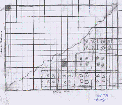
As a group we decided to make all of our
lots on one side of the creek. We decided to make only 4 large lots. It
was easiest for us to make all of the lots the same size. That way we could
organize them in the half of the land. We could have figured it out differently
but it would have been tougher. If we would have had more time we could
have come out with more ideas. It took us a long time to understand the
question and come to an agreement on a plan there were so many ideas that
it was tough. |